Atlases & Resources
Interactive maps and reference pages on Turkmenistan's history, resources and landscape.
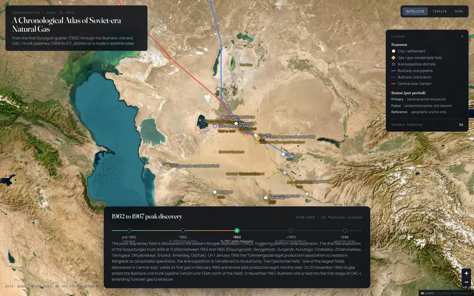
A Chronological Atlas of Soviet-era Natural Gas in Turkmenistan, 1950 to 1976
31 fields, wells and pipelines across five periods, plotted on a modern satellite base: from the first gas gusher at the Gyzylgum field (1952) to the Bukhara to Ural and Central Asia to Center trunk pipelines (1966 and 1967). Each feature carries sourced descriptions, key facts, coordinates and a confidence level.
Sources: O. Kheshdekov, "Early history of natural gas in Turkmenistan," News Central Asia, 22 May 2024; USGS Bulletin 2201-H (Ulmishek 2004). Basemap: Esri World Imagery.
Open the atlasReference pages
Each page gathers his writing on one subject, newest first.
Turkmenistan's natural gasFields, pipelines and buyers, from the Soviet-era discoveries to Galkynysh and the Trans-Caspian debate.
Minerals beyond gasIodine, bromine and salt from underground brines and the Garabogazköl basin.
The Akhal-Teke and the 1935 rideThe 1935 ride from Ashgabat to Moscow, the breed and the horse economy.
Turkmenistan and the CaspianSix research areas and a history lane on one map, each with its own writing and photos.
Commission a map or brief
Working to a deadline: put DEADLINE in the subject line.